Monitoring Trail Transformation, Environmental Reserve, Bighill Creek
By Vivian Pharis, Board Member, BCPS
BCPS determined that it would wise to begin a formal set of annual measurements of the main loop trail through the Environmental Reserve that we now steward. I was tasked with setting up a number of measurement sites and with taking the initial photographs and measurements this summer.
I established seven measurement sites along the trail, the first three being on the stretch of the ER trail that is actually on Mt. St. Francis Retreat land. A portion of the ER trail begins at our sign near the last vehicle bridge upstream on Bighill Creek, is on Retreat land that BCPS stewards under a special agreement with Mt. St. Francis. The final four sites lie along the south-side trail, except for site 7 that measures a piece of trail leading from the bridge up to the decommissioned road on the north side of the reserve.
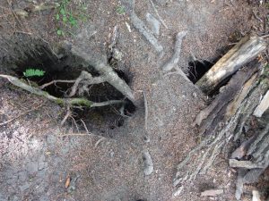
Eroded section of trail already in need of rehabilitation. The trail has now been rerouted around this portion.
Human use of the ER loop trail has greatly increased in the last few years, and with the example of the very overused and eroded Big Hill Springs Provincial Park at the upper end of the valley, BCPS Board members are concerned that ER trails do not suffer similar overuse.
This is going to mean regular monitoring, and possible use adjustment, trail maintenance and trail re positioning. We have now closed a short, steep portion of the south loop and will begin some rehabilitation of this site. This closed section is now signed and a new, higher trail has been flagged for through use.
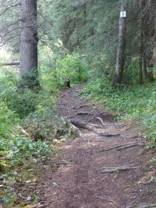
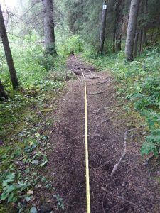
This summer BCPS initiated a monitoring program for the loop trail through the Environmental Reserve. Seven sites were chosen for annual measurement in order to monitor erosion. Each site was measured and photographed.
The above two photos show the expanded and very eroded state of trails through Big Hill Springs Provincial Park.
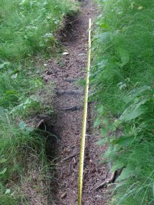
Seven sections of the loop trail have been selected for annual measurement and for photographic record in order to monitor erosion.
BCPS is hoping to prevent this sort of extreme damage to trails within the Environmental Reserve
The photos above measure other trail segments,
below shows a portion of the Environmental
Reserve loop trail that is already in need of
restoration.
